
Posted by
mountainbikerak
Joined Mar 6, '18
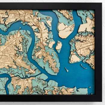
I’d like to share this laser-cut nautical chart of the upper Lynn Canal near Haines, AK (NOAA chart 17317, if you’re curious). I wanted to create something similar to the other oceanic charts you may have seen online, but much more personalized. Growing up, I spent countless hours studying this chart while on my dad’s fishing boat. It’s half the reason why I have such an interest in maps.
I created this using Adobe Illustrator, both to engrave the design on the draft board, and to cut the various layers of water. I then used watercolor paint to paint the different shades of blue for the different different depths of water. I also had to glue a few islands into place with superglue. Apart from that, everything else is bolted together.
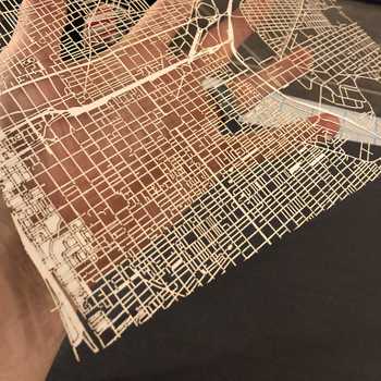
This project really pushed the boundaries of what’s possible with a Glowforge. I ran into problems with the files being too large for the web interface. I also ran into problems with the DPI being too high to process. I also ran into issues with Illustrator losing resolution with its rasterize process. Fortunately, I was able to find a workaround for each problem.
I have even more photos at this album, including several steps along the way. http://bit.ly/2UMetUB


Start with an idea. Create your design. Hold something in your hand you only imagined an hour ago. Glowforge makes that possible.

From idea to design to creation. No matter what you want to make your Glowforge can help you make it happen.